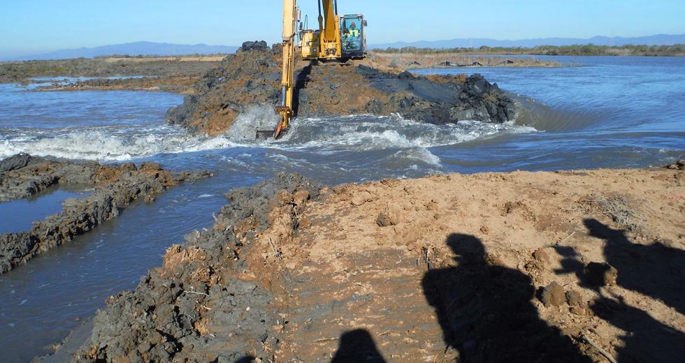
Early this year, saltwater came gushing through a levee that had kept a vast pasture at the north edge of San Pablo Bay dry for more than a century. The breach was no accident.
Cullinan Ranch, a large piece of federal property at the southwestern corner of Solano County, was used for hay farming and rangeland beginning in the 1880s, when the wetland was dyked and drained — a fate that has befallen most of the marshes surrounding San Francisco Bay. But a group of local citizens began lobbying in the 1980s for a restoration project that would protect the land from development and also restore the land to its historic state as a vast tidal zone. Algae, clams and bat rays, seals, hawks and grizzly bears: All thrived here. And while the bears won’t likely return, fully returning a drained wetland to its previous state is often a rather easy endeavor: Just add water.
Related: Photos — Cullinan Ranch Restoration
In this case, after years of preliminary reinforcements to protect Highway 37 from water damage, a levee was breached on January 6. Then, land that had shriveled and sunken to six feet below sea level in the preceding century was inundated in just minutes.
The process of sedimentation and re-vegetation could take 60 years, but already, fish and wildlife are taking advantage of the refuge, says Francesca Demgen, a local ecologist and president of the Friends of the San Pablo Bay Wildlife Refuge.
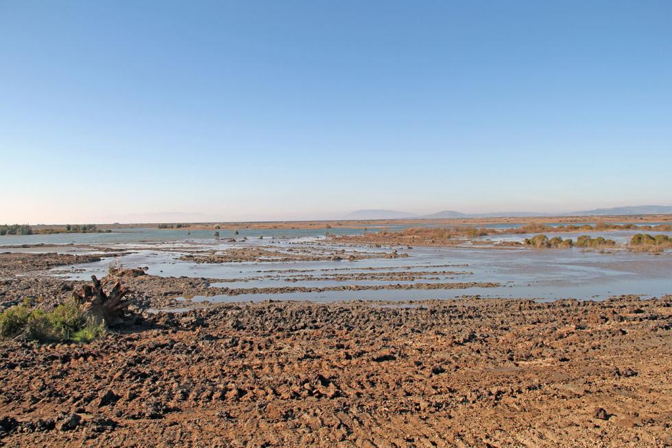
Portion of Cullinan Ranch, taken the day of the breach

Within an hour of the breach, waterfowl were paddling about several feet above the former hay fields, and herring used the flooded tideland as a spawning site in January, Demgen says. Sturgeon, many kinds of waterfowl, and steelhead trout and Chinook salmon, both of which spawn in the nearby Napa River, will also take advantage of the new habitat, if they haven’t already.
Cullinan Ranch is considered so valuable to local land conservation efforts in part because of its size. Indeed, it is big — 1,493 acres, and while it will become a treasure for kayakers, birders and hikers, it was once a coveted piece of real estate. A development plan in the 1980s would have covered the property with thousands of homes and 60 acres of commercial real estate, plus 1,700 boat slips along the waterfront. This threat prompted fierce objections from locals, and a grassroots group called Citizens for Cost Efficient Growth led a successful effort to derail the plan.
The U.S. Fish and Wildlife Service cemented Cullinan’s preservation when it purchased the land in 1991 and incorporated it into the San Pablo Bay Wildlife Refuge.
“If Cullinan had gone down, it would have been the end of the North Bay wildlife corridor,” says Demgen, who was closely involved in the battle to save Cullinan 30 years ago.
To drivers along Highway 37, the recent restoration work has been highly visible — especially a long line of prominent dishwasher-sized white blocks placed in the ditch on the north side of the road. Those were hunks of what engineers call “geofoam,” a buoyant material that was used to support tons of earth placed along the road as protection against wave erosion.
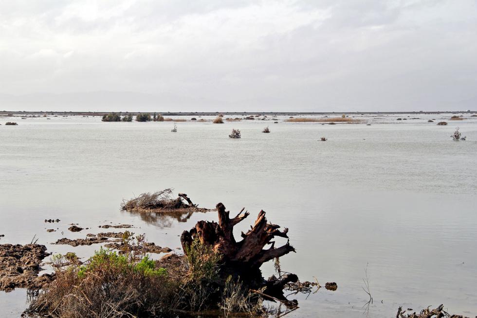
Same portion of Cullinan Ranch as above, one month after the
breach

Russ Lowgren, a regional engineer with Ducks Unlimited, one of the groups that spearheaded the Cullinan restoration project, says layering material along the road, while it would have fended off water damage, could also have caused the freeway to sink into the mud. But the 15,000 cubic yards of geofoam will counter the weight of the debris. Now, the highway will be guarded from waves and protected from subsidence.
Trails, a fishing pier and a kayak launch dock already provide access for the public, and the groups that supported the Cullinan restoration have their eyes on a number of other potential shoreline projects to the west. While the land is indefinitely preserved, just how natural processes will unfurl on the Cullinan Ranch is not certain. The idea behind the $15-million project is that mud will slowly fill in the land via the levee breach at the east end of the property.
But polar ice caps are melting, and it’s a phenomenon, according to Lowgren, that could affect the project.
“There is certainly a fear that the natural accretion of sediment will not keep pace with sea level rise,” Lowgren says.
Whatever happens, ecologists are taking a unique opportunity to watch as a tidal marsh is born — or, that is, born again.


Comments
Can you tell me what those small wooden structures on the Cullinan Ranch Restoration project near Sears point(Western side) as seen from highway 37. Somebody suggested duck blinds but I don't think so. Can you help me?
I drive by there often and have been wondering the same thing. I'll see what we can dig up.